 |
|
You are here: Sipapu>Main Web>RadioHaloMaps (09 Sep 2016, PaulRicker)Edit Attach
Radio Halo Sky Maps
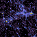
This page hosts publicly-available radio sky maps used in our work. There are three all-sky maps in the FITS file format for each model: one each for resolutions of 120, 240, and 3600 arcseconds. All maps assume 0 mJy sensitivity thresholds. Maps are named after the model parameters used to generate them (see the paper for details).- maps.tar.gz: Synthetic radio sky images


| I |
Attachment | Action | Size | Date | Who | Comment |
|---|---|---|---|---|---|---|
| |
maps.tar.gz | manage | 70 MB | 09 Sep 2016 - 16:15 | PaulRicker | Synthetic radio sky images |
Edit | Attach | Print version | History: r2 < r1 | Backlinks | View wiki text | Edit wiki text | More topic actions
Topic revision: r2 - 09 Sep 2016, PaulRicker


Ideas, requests, problems regarding Sipapu? Send feedback